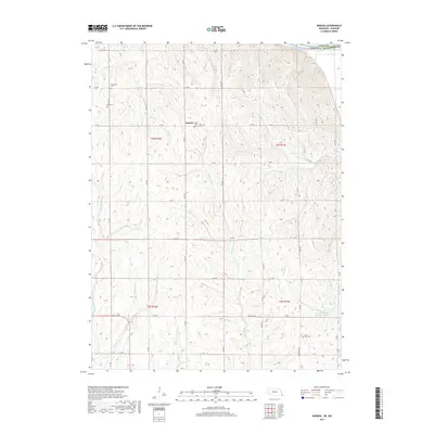
2017 Map of Barada
USGS Topo · Published 2017About this map
Barada sits atop the dissected plateau of Richardson County, Nebraska, overlooking a complex network of drainages that feed toward the Missouri River along the eastern boundary. This 2017 survey reveals a landscape deeply connected to its pioneer and family history, evidenced by a high density of rural cemeteries including Harris Cem, Saint Anns Cem, and Moorhead Cem. The terrain is defined by the sharp incisions of Beadlow Cr, Halfbreed Cr, and Winnebago Cr, which create a rugged relief uncommon for the central plains. Transportation is managed by a strict grid of section roads like 653 Ave and 714 Rd, while the interestingly named Dustless Hwy cuts across the southern portion of the quadrangle. Modern land management is visible in features like the Winnebago Cr Reservoir 48-3A, which stands in contrast to the natural winding paths of Silver Cr and Goolsby Br.
Find a feature on this map
41 named features on this map. Tap any name to fly to it.
Don’t see what you’re looking for? This feature index may not catch every label — zoom into the map to look around manually.
Map Details
Editions of this 2017 Barada Map
This is the sole edition of this map. No revisions or reprints were ever made.
Other maps of this area

1915 · Falls City
USGS Topo · 1:62,500

1915 · Nemaha
USGS Topo · 1:62,500

1920 · Craig
USGS Topo · 1:62,500

1936 · Fairfax
USGS Topo · 1:24,000

1939 · Tarkio
USGS Topo · 1:62,500

1939 · Nemaha
USGS Topo · 1:62,500

1940 · Tarkio
USGS Topo · 1:62,500

1941 · Tarkio
USGS Topo · 1:62,500

1949 · Nemaha
USGS Topo · 1:62,500

1955 · Nebraska City
USGS Topo · 1:250,000