
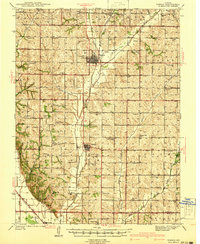
1941 Map of Tarkio
USGS Topo · Published 1941About this map
Tarkio College stands as a focal point of this Northwest Missouri landscape just before the United States entered World War II. The terrain is defined by the branching waterways of the Tarkio River, including West Tarkio Creek, Middle Tarkio Creek, and Little Tarkio Creek. This survey reveals a dense network of rural infrastructure, with schoolhouses such as National Sch, Evening Star Sch, and Moulton Sch spaced frequently across the townships of Polk, Lincoln, and Colfax.
Find a feature on this map
71 named features on this map. Tap any name to fly to it.
Don’t see what you’re looking for? This feature index may not catch every label — zoom into the map to look around manually.
Map Details
Editions of this 1941 Tarkio Map
2 editions found
Other maps of this area

1915 · Falls City
USGS Topo · 1:62,500

1915 · Nemaha
USGS Topo · 1:62,500

1920 · Craig
USGS Topo · 1:62,500

1926 · Maitland
USGS Topo · 1:62,500

1936 · Fairfax
USGS Topo · 1:24,000

1939 · Tarkio
USGS Topo · 1:62,500

1939 · Farragut
USGS Topo · 1:62,500

1939 · Skidmore
USGS Topo · 1:62,500

1939 · Hamburg
USGS Topo · 1:62,500

1939 · Nemaha
USGS Topo · 1:62,500