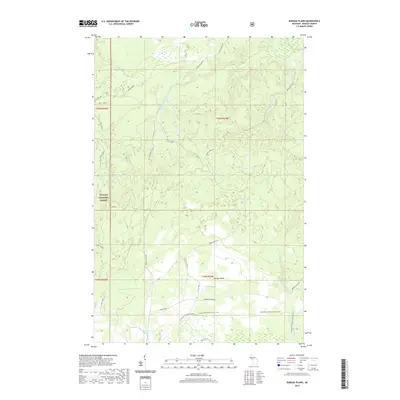
2019 Map of Baraga Plains
USGS Topo · Published 2019About this map
Ottawa National Forest encompasses much of this landscape in the western Upper Peninsula, where the high, flat geography of the Baraga Plains creates a unique network of drainage and isolated basins. The southern portion of the map is defined by the route of the N Country National Scenic Trail, which skirts the edge of several small water bodies including Little Lake and Robillard Lake.
Find a feature on this map
39 named features on this map. Tap any name to fly to it.
Don’t see what you’re looking for? This feature index may not catch every label — zoom into the map to look around manually.
Map Details
Editions of this 2019 Baraga Plains Map
This is the sole edition of this map. No revisions or reprints were ever made.
Other maps of this area

1954 · Keweenaw Bay
USGS Topo · 1:62,500

1954 · Pelkie
USGS Topo · 1:62,500

1954 · Sidnaw
USGS Topo · 1:62,500

1955 · Herman
USGS Topo · 1:62,500

1958 · Iron River
USGS Topo · 1:250,000

1960 · Iron River
USGS Topo · 1:250,000

1961 · Iron River
USGS Topo · 1:250,000

1967 · Iron River
USGS Topo · 1:250,000
1985 · L'Anse
USGS Topo · 1:24,000
1985 · Bear Town
USGS Topo · 1:24,000