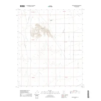
2018 Map of Baragan Mountain
USGS Topo · Published 2018About this map
Baragan Mtn stands as the central topographic anchor of this arid Yuma County landscape, surrounded by a complex network of ephemeral desert drainages. This high ground is flanked by several significant watercourses, most notably Red Raven Wash to the west and Clanton Wash to the east. The terrain is characterized by the convergence of these washes, including Deadman Wash and the descriptively named Stone Cabin Gap Wash in the northern reaches of the quadrangle. A structured grid of desert roads, such as Palomas Harquahala Rd and Blackhill Rd, cuts across the flats between the mountain and the drainage basins. The map illustrates a largely undeveloped region defined by its hydrography and the transition from mountain slopes to the alluvial fans of Nottbusch Wash in the northeast corner.
Find a feature on this map
26 named features on this map. Tap any name to fly to it.
Don’t see what you’re looking for? This feature index may not catch every label — zoom into the map to look around manually.
Map Details
Editions of this 2018 Baragan Mountain Map
This is the sole edition of this map. No revisions or reprints were ever made.
Other maps of this area

1927 · Hyder
USGS Topo · 1:62,500

1929 · Aztec
USGS Topo · 1:62,500

1930 · Stoval
USGS Topo · 1:62,500

1930 · Hyder
USGS Topo · 1:62,500

1942 · Vicksburg
USGS Topo · 1:250,000

1950 · Stoval
USGS Topo · 1:62,500

1950 · Aztec
USGS Topo · 1:62,500

1953 · Ajo
USGS Topo · 1:250,000

1954 · Phoenix
USGS Topo · 1:250,000

1957 · Ajo
USGS Topo · 1:250,000