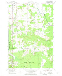
1951 Map of Barbeau
USGS Topo · Published 1973About this map
Munuscong State Forest covers the southern reaches of this Eastern Upper Peninsula landscape, where drainage patterns define the rural settlement of Bruce Township. The mid-century survey reveals a highly organized educational network, with small schools such as Parkerville Sch, West McCarron Sch, and East McCarron Sch serving localized farm clusters. These crossroads communities, including Donaldson, McCarron, and Barbeau, are connected by a grid of dirt and unimproved roads like Shunk Road and Meridian Road. The presence of several institutional markers, including the Donaldson Cem and the McCarron Ch, alongside the Barbeau Tower, illustrates a stable rural society before the consolidation of the late 20th century. Waterways like the Charlotte River and the Little Munuscong River meander through the woodlots and fields, influencing the placement of early homesteads and schools like the Corktown Sch.
Find a feature on this map
27 named features on this map. Tap any name to fly to it.
Don’t see what you’re looking for? This feature index may not catch every label — zoom into the map to look around manually.
Map Details
Editions of this 1951 Barbeau Map
3 editions found
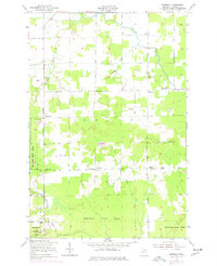
Other maps of this area

1913 · Sault Sainte Marie
USGS Topo · 1:62,500

1919 · Neebish
USGS Topo · 1:62,500

1941 · Neebish
USGS Topo · 1:63,360

1941 · Sault Sainte Marie
USGS Topo · 1:63,360

1951 · Shallows
USGS Topo · 1:24,000

1951 · Dafter
USGS Topo · 1:24,000

1951 · Barbeau
USGS Topo · 1:24,000

1951 · Baie De Wasai
USGS Topo · 1:24,000

1951 · Oak Ridge
USGS Topo · 1:24,000

1951 · Sault Ste. Marie
USGS Topo · 1:62,500