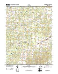
2013 Map of Barboursville
USGS Topo · Published 2013About this map
Barboursville and Ruckersville anchor this 2013 survey of the Virginia Piedmont, where agricultural heritage meets modern viticulture. The landscape is characterized by its transition from the rolling lowlands of Preddy Cr and Blue Run to the prominent elevations of Hardwick Mountain and Peters Mountain in the southeast. This era shows the established presence of the local wine industry with both Barboursville Winery and Burnleys Vineyard clearly marked, alongside traditional family-named landmarks like Red Horse Farm and Word Farm Pond.
Find a feature on this map
142 named features on this map. Tap any name to fly to it.
Don’t see what you’re looking for? This feature index may not catch every label — zoom into the map to look around manually.
Map Details
Editions of this 2013 Barboursville Map
This is the sole edition of this map. No revisions or reprints were ever made.
Other maps of this area

1892 · Gordonsville
USGS Topo · 1:125,000

1930 · Madison
USGS Topo · 1:48,000

1933 · Madison
USGS Topo · 1:62,500

1935 · Charlottesville
USGS Topo · 1:62,500

1939 · Charlottesville
USGS Topo · 1:62,500

1949 · Charlottesville
USGS Topo · 1:250,000

1949 · Charlottesville
USGS Topo · 1:62,500

1956 · Charlottesville
USGS Topo · 1:250,000

1961 · Gordonsville
USGS Topo · 1:62,500

1961 · Rapidan
USGS Topo · 1:62,500