
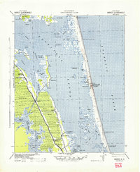
1940 Map of Barco
USGS Topo · Published 1940About this map
Currituck Sound dominates this landscape, separating the mainland from the narrow barrier spit where the community of Corolla and the Currituck Beach Lighthouse stand. Along the mainland's eastern edge, settlements like Aydlett, Poplar Branch, and Bertha are connected by U.S. Route 158, while the Inland Waterway carves a straight path through the Great Swamp and Coinjock to reach the North River.
Find a feature on this map
68 named features on this map. Tap any name to fly to it.
Don’t see what you’re looking for? This feature index may not catch every label — zoom into the map to look around manually.
Map Details
Editions of this 1940 Barco Map
2 editions found
Other maps of this area

1893 · Virginia Beach
USGS Topo · 1:125,000

1916 · Back Bay
USGS Topo · 1:62,500

1939 · Moyock
USGS Topo · 1:62,500

1940 · Kitty Hawk
USGS Topo · 1:62,500

1940 · Powells Point
USGS Topo · 1:62,500

1940 · Wade Point
USGS Topo · 1:62,500

1943 · Wade Point
USGS Topo · 1:62,500

1943 · Back Bay
USGS Topo · 1:62,500

1946 · Moyock
USGS Topo · 1:62,500

1946 · Eastville
USGS Topo · 1:250,000