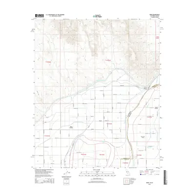
2015 Map of Bard
USGS Topo · Published 2015About this map
The Colorado River forms a winding border between California and Arizona, anchoring a landscape defined by an intricate network of irrigation and water management. This area in the North Gila Valley relies on major engineering works like the All-American Canal, Reservation Main Canal, and Cocopah Canal to sustain agriculture in the arid borderlands. Small agricultural communities such as Bard, Ross Corner, and Kool Corner are situated among a geometric grid of rural roads and drainage features like the Reservation Main Drain. The presence of Potholes Cemetery near the river reflects the local history of the region, while natural features like Bard Lake, Haughtelin Lake, and Picacho Wash punctuate the heavily managed terrain. The map provides a clear record of the Imperial County and Yuma County boundary as it follows the river's path, illustrating the intersection of state lines and vital water infrastructure.
Find a feature on this map
82 named features on this map. Tap any name to fly to it.
Don’t see what you’re looking for? This feature index may not catch every label — zoom into the map to look around manually.
Map Details
Editions of this 2015 Bard Map
This is the sole edition of this map. No revisions or reprints were ever made.
Other maps of this area

1903 · Yuma
USGS Topo · 1:125,000

1905 · Yuma
USGS Topo · 1:125,000

1926 · Fortuna
USGS Topo · 1:62,500

1929 · Fortuna
USGS Topo · 1:62,500

1929 · Laguna
USGS Topo · 1:62,500

1940 · Yuma
USGS Topo · 1:62,500

1942 · Yuma
USGS Topo · 1:250,000

1943 · Laguna
USGS Topo · 1:62,500

1945 · Picacho Peak
USGS Topo · 1:62,500

1945 · Yuma
USGS Topo · 1:62,500