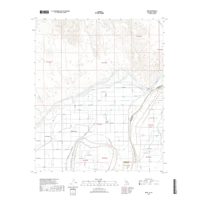
2018 Map of Bard
USGS Topo · Published 2018About this map
Bard and Ross Corner sit at the center of an intricate irrigation network in the lower Colorado River Valley, where the state lines of California and Arizona meet. This desert landscape is defined by the massive All-American Canal and the Reservation Main Canal, which divert water from the Colorado River to support the region's agricultural blocks. The grid of rural roads, including W Ross Rd and Haughtlin Rd, reflects a highly organized land-use system designed to maximize the reach of smaller waterways like the McPherson Canal and W Main Canal. North of the irrigated fields, the terrain shifts to the arid drainage patterns of Mission Wash and Picacho Wash. The presence of the Potholes Cem near the river bend provides a poignant connection to the early residents who worked this hydraulic landscape.
Find a feature on this map
61 named features on this map. Tap any name to fly to it.
Don’t see what you’re looking for? This feature index may not catch every label — zoom into the map to look around manually.
Map Details
Editions of this 2018 Bard Map
This is the sole edition of this map. No revisions or reprints were ever made.
Other maps of this area

1903 · Yuma
USGS Topo · 1:125,000

1905 · Yuma
USGS Topo · 1:125,000

1926 · Fortuna
USGS Topo · 1:62,500

1929 · Fortuna
USGS Topo · 1:62,500

1929 · Laguna
USGS Topo · 1:62,500

1940 · Yuma
USGS Topo · 1:62,500

1942 · Yuma
USGS Topo · 1:250,000

1943 · Laguna
USGS Topo · 1:62,500

1945 · Picacho Peak
USGS Topo · 1:62,500

1945 · Yuma
USGS Topo · 1:62,500