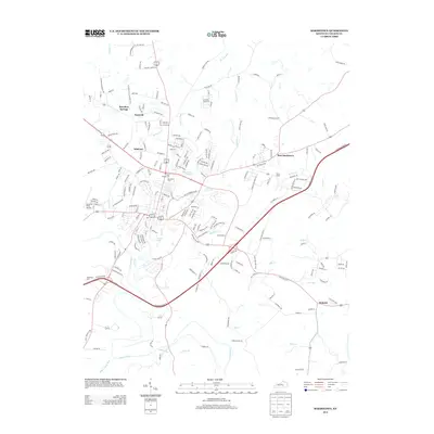
2013 Map of Bardstown
USGS Topo · Published 2013About this map
The Nazareth campus and the surrounding Nelson County landscape are meticulously documented in this 2013 survey, showcasing a mix of religious heritage and industrial sites. Central to the area is the community of Nazareth, situated north of the main settlement hub, while the Early Times facility highlights the region's enduring connection to the bourbon industry. Water features like the Bardstown Reservoir and Barton Lake are key landmarks, alongside the winding path of Beech Fork and Cane Run.
Find a feature on this map
204 named features on this map. Tap any name to fly to it.
Don’t see what you’re looking for? This feature index may not catch every label — zoom into the map to look around manually.
Map Details
Editions of this 2013 Bardstown Map
This is the sole edition of this map. No revisions or reprints were ever made.
Other maps of this area

1949 · Cravens
USGS Topo · 1:24,000

1949 · Samuels
USGS Topo · 1:24,000

1949 · Shepherdsville
USGS Topo · 1:62,500

1953 · Loretto
USGS Topo · 1:24,000

1953 · Maud
USGS Topo · 1:24,000

1953 · Saint Catharine
USGS Topo · 1:24,000

1953 · Bardstown
USGS Topo · 1:24,000

1953 · New Haven
USGS Topo · 1:24,000

1953 · Bloomfield
USGS Topo · 1:24,000

1953 · Fairfield
USGS Topo · 1:24,000