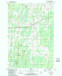
1989 Map of Bark River
USGS Topo · Published 1989About this map
The Hannahville Indian Community occupies a central role in this late-1980s landscape, positioned near the border of Menominee and Delta counties. This area illustrates a rural network of small settlements and educational hubs, most notably the Bark River-Harris School which bridges the communities of Harris and Bark River. The terrain is characterized by a dense system of waterways including the Ford River, the Bark River, and Pine Creek, interspersed with numerous wetlands and small lakes like First Lake and Second Lake.
Find a feature on this map
30 named features on this map. Tap any name to fly to it.
Don’t see what you’re looking for? This feature index may not catch every label — zoom into the map to look around manually.
Map Details
Editions of this 1989 Bark River Map
This is the sole edition of this map. No revisions or reprints were ever made.
Other maps of this area

1932 · Bark River NE
USGS Topo · 1:31,680

1932 · Whitney SE
USGS Topo · 1:31,680

1932 · Gladstone SW
USGS Topo · 1:31,680

1954 · Escanaba
USGS Topo · 1:250,000

1957 · Escanaba
USGS Topo · 1:250,000

1958 · Escanaba
USGS Topo · 1:250,000

1958 · Gladstone
USGS Topo · 1:62,500

1958 · Escanaba
USGS Topo · 1:62,500

1963 · Bark River
USGS Topo · 1:62,500

1963 · Schaffer
USGS Topo · 1:62,500