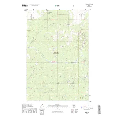
2020 Map of Barker
USGS Topo · Published 2020About this map
Hughesville and the Barker Cem sit along the eastern edge of the Little Belt Mountains, marking a transition from high peaks into deep drainage gulches. This high-elevation terrain within the Lewis & Clark National Forest is defined by a dense network of watercourses including Dry Fork Belt Cr, Bender Creek, and Villars Creek, which carve into the steep slopes of Barker Mtn and Otter Mtn. The map reveals a complex system of ridges, such as Sawmill Ridge and Hoover Ridge, which dictated the early movement of people and resources through the mountains. Numerous named coulees and gulches like Colarchik Cabin Coulee and McKay Gulch indicate a landscape shaped by both water and seasonal runoff, while the presence of scattered property boundaries and forest development roads points toward the area's ongoing management for timber and recreation.
Find a feature on this map
71 named features on this map. Tap any name to fly to it.
Don’t see what you’re looking for? This feature index may not catch every label — zoom into the map to look around manually.
Map Details
Editions of this 2020 Barker Map
This is the sole edition of this map. No revisions or reprints were ever made.
Other maps of this area

1886 · Little Belt Mts.
USGS Topo · 1:250,000

1890 · Fort Benton
USGS Topo · 1:250,000

1892 · Fort Benton
USGS Topo · 1:250,000

1894 · Little Belt Mts.
USGS Topo · 1:250,000

1897 · Fort Benton
USGS Topo · 1:250,000

1897 · Little Belt Mts.
USGS Topo · 1:250,000

1898 · Little Belt Mts.
USGS Topo · 1:250,000

1902 · Little Belt Mts.
USGS Topo · 1:250,000

1948 · White Sulphur Springs
USGS Topo · 1:250,000

1954 · Great Falls
USGS Topo · 1:250,000