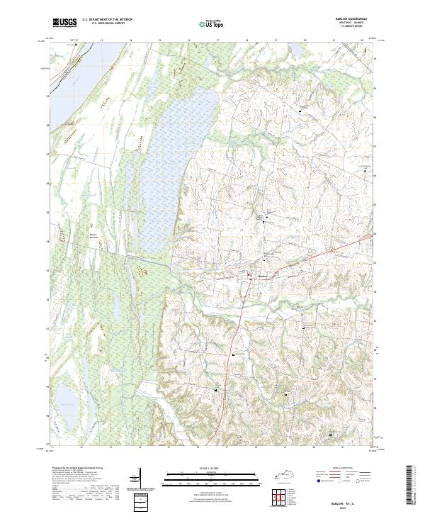
2022 Map of Barlow
USGS Topo · Published 2022About this map
Barlow serves as the central settlement in this region of Ballard County, situated just east of the expansive wetlands and sloughs that define the river valley. The landscape is characterized by a high concentration of family burial grounds and historical cemeteries, such as the Bridgewater Graveyard and the Miller Graveyard Number 2, which provide essential touchstones for local genealogical research. To the west, the Ohio River forms the state boundary with Illinois, creating a complex hydrologic network of backwaters including Honey Lake, Buck Lake, and Deep Slough. This environment is punctuated by Cache Island and the broad Barlow Bottoms, illustrating a terrain where seasonal flooding and permanent water bodies have long influenced land use and road placement. These natural features, combined with the presence of the Barlow - International Order of Odd Fellows Cem, reflect a community deeply rooted in its local landscape and history.
Find a feature on this map
80 named features on this map. Tap any name to fly to it.
Don’t see what you’re looking for? This feature index may not catch every label — zoom into the map to look around manually.
Map Details
Editions of this 2022 Barlow Map
This is the sole edition of this map. No revisions or reprints were ever made.
Other maps of this area

1928 · La Center
USGS Topo · 1:62,500

1931 · Cairo
USGS Topo · 1:62,500

1932 · La Center
USGS Topo · 1:62,500

1933 · Cairo
USGS Topo · 1:62,500

1939 · Wickliffe
USGS Topo · 1:62,500

1939 · Cairo
USGS Topo · 1:62,500

1949 · Paducah
USGS Topo · 1:250,000

1950 · Paducah
USGS Topo · 1:250,000

1951 · Blandville
USGS Topo · 1:24,000

1951 · Wickliffe
USGS Topo · 1:24,000