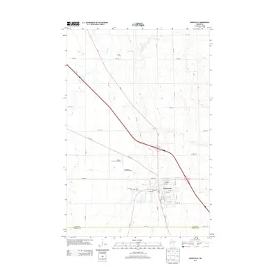
2013 Map of Barnesville
USGS Topo · Published 2013About this map
Barnesville serves as the central hub of this prairie landscape, situated near the intersection of MN-9 and Co HWY-52. The town's layout is defined by a grid of numbered streets and avenues, including Front St S and 13th St NE, bordering the small waters of Blue Eagle Lake. The surrounding Clay County countryside is heavily marked by a network of drainage and creek systems such as Stony Cr and Whisky Cr, essential features in this agricultural region. Genealogists will find significant value in the documentation of several local burial grounds, including Elkton Cem to the north and the clustered Saint Marys Cem and Rosemound Cem on the town's western edge. The presence of both the Barnesville Municipal Airport and the Mathew Private Field Airport highlights the importance of general aviation in the rural commerce of this early 21st-century Minnesota community.
Find a feature on this map
45 named features on this map. Tap any name to fly to it.
Don’t see what you’re looking for? This feature index may not catch every label — zoom into the map to look around manually.
Map Details
Editions of this 2013 Barnesville Map
This is the sole edition of this map. No revisions or reprints were ever made.
Other maps of this area

1895 · Fargo
USGS Topo · 1:125,000

1897 · Fargo
USGS Topo · 1:125,000

1919 · Barnesville
USGS Topo · 1:62,500

1919 · Hawley
USGS Topo · 1:62,500

1952 · Barnesville
USGS Topo · 1:62,500

1953 · Fargo
USGS Topo · 1:250,000

1956 · Fargo
USGS Topo · 1:250,000

1964 · Baker
USGS Topo · 1:24,000
1964 · Glyndon South
USGS Topo · 1:24,000
1966 · Wolverton SE
USGS Topo · 1:24,000