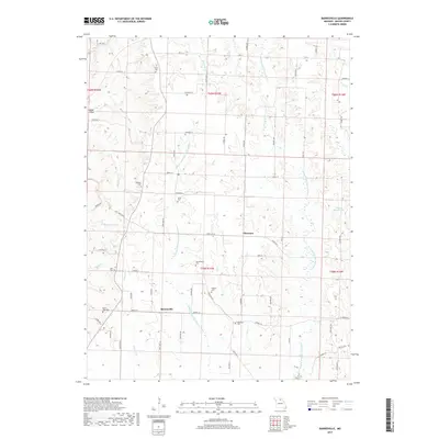
2017 Map of Barnesville
USGS Topo · Published 2017About this map
Barnesville and Plainview anchor this section of Macon County, where the landscape is defined by the branching waterways of the Little Chariton River system. The Middle Fork Little Chariton River and E Fork Little Chariton River carve deep, irregular paths through the terrain, creating a complex network of ridges and valleys. This 2017 survey reveals a deeply rooted rural community, evidenced by the high density of small family or community burial grounds scattered throughout the township sections. Genealogists and local historians can find specifically named sites such as Quail Trap Cem, Murry Cem, and Hertzler Cem. To the northwest, the settlement of Happy Hollow sits near the edge of the quadrangle, while George Baake Lake serves as a prominent water feature in the eastern reaches. The road network, including State Hwy J and State Hwy O, follows the natural contours of the land, connecting these isolated cemeteries and small clusters of homes.
Find a feature on this map
47 named features on this map. Tap any name to fly to it.
Don’t see what you’re looking for? This feature index may not catch every label — zoom into the map to look around manually.
Map Details
Editions of this 2017 Barnesville Map
This is the sole edition of this map. No revisions or reprints were ever made.
Other maps of this area

1903 · Edina
USGS Topo · 1:125,000

1908 · Atlanta
USGS Topo · 1:62,500

1937 · Elmer
USGS Topo · 1:48,000

1938 · Kirksville
USGS Topo · 1:62,500

1940 · Kirksville
USGS Topo · 1:62,500

1942 · Elmer
USGS Topo · 1:62,500

1953 · Moberly
USGS Topo · 1:250,000

1954 · Centerville
USGS Topo · 1:250,000

1954 · Moberly
USGS Topo · 1:250,000

1957 · Moberly
USGS Topo · 1:250,000