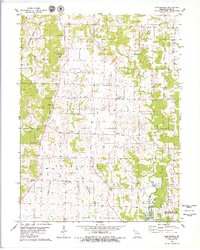
1979 Map of Barnesville
USGS Topo · Published 1979About this map
Barnesville serves as a quiet focal point in this Macon County landscape, situated amidst the complex drainage patterns of the Middle Fork Little Chariton River and its numerous tributaries. This late 1970s survey documents a rural environment deeply rooted in local history, evidenced by a high density of family and community burial grounds such as Quail Trap Cem, Hockensmith Cem, and Hertzler Cem. The topography is defined by the divides between Sweezer Creek, Buck Creek, and the East Fork Little Chariton River. In the southeast, the creation of Long Branch Lake and the establishment of the Atlanta State Wildlife Area mark a significant transition toward conservation and water management. Transportation is anchored by the Atchison Topeka and Santa Fe railroad corridor cutting through the northwest, while small community landmarks like Chariton Ridge Ch and Plainview persist as markers of the area's social geography.
Find a feature on this map
27 named features on this map. Tap any name to fly to it.
Don’t see what you’re looking for? This feature index may not catch every label — zoom into the map to look around manually.
Map Details
Editions of this 1979 Barnesville Map
This is the sole edition of this map. No revisions or reprints were ever made.
Other maps of this area

1903 · Edina
USGS Topo · 1:125,000

1908 · Atlanta
USGS Topo · 1:62,500

1937 · Elmer
USGS Topo · 1:48,000

1938 · Kirksville
USGS Topo · 1:62,500

1940 · Kirksville
USGS Topo · 1:62,500

1942 · Elmer
USGS Topo · 1:62,500

1953 · Moberly
USGS Topo · 1:250,000

1954 · Centerville
USGS Topo · 1:250,000

1954 · Moberly
USGS Topo · 1:250,000

1957 · Moberly
USGS Topo · 1:250,000