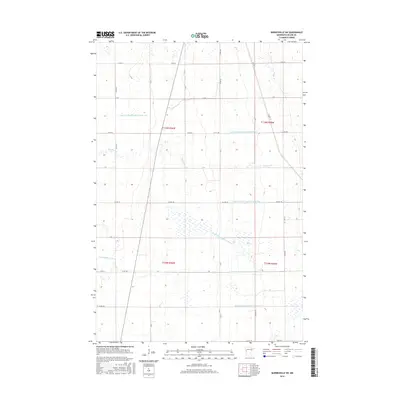
2016 Map of Barnesville SW
USGS Topo · Published 2016About this map
Agricultural engineering dominates this portion of Wilkin County, where an extensive network of water management features has reshaped the prairie landscape. The natural path of Deerhorn Cr and the S Br Buffalo River are augmented by a strictly organized system of man-made waterways. These features, including State Ditch Number Fourteen and a series of judicial ditches such as Judicial Ditch Number Three-One and Judicial Ditch Number Three-Four, reflect a century-long effort to drain the fertile land for large-scale farming. The map captures the geometric precision of the Public Land Survey System, with section lines and rural roads like Co Hwy 30 and 130th St forming a rigid grid across the terrain. This environment illustrates the transition from native wetlands to one of the most productive agricultural regions in the country.
Find a feature on this map
24 named features on this map. Tap any name to fly to it.
Don’t see what you’re looking for? This feature index may not catch every label — zoom into the map to look around manually.
Map Details
Editions of this 2016 Barnesville SW Map
This is the sole edition of this map. No revisions or reprints were ever made.
Other maps of this area

1895 · Fargo
USGS Topo · 1:125,000

1897 · Fargo
USGS Topo · 1:125,000

1904 · Wahpeton
USGS Topo · 1:125,000

1919 · Rothsay
USGS Topo · 1:62,500

1919 · Barnesville
USGS Topo · 1:62,500

1951 · Rothsay
USGS Topo · 1:62,500

1952 · Barnesville
USGS Topo · 1:62,500

1953 · Fargo
USGS Topo · 1:250,000

1956 · Fargo
USGS Topo · 1:250,000

1964 · Baker
USGS Topo · 1:24,000