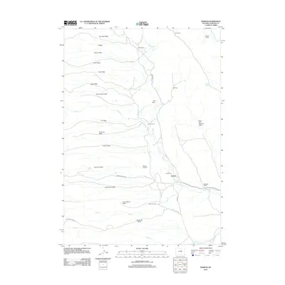
2012 Map of Barnum
USGS Topo · Published 2012About this map
Barnum serves as a central point in this ranching landscape of the southern Big Horn Mountains, where the high plains meet the eastern slopes. The settlement and surrounding homesteads like Graves Ranch and Wolcott Ranch rely on an intricate network of irrigation channels, including the Winsor Ditch, White Panther Ditch, and Barnum Ditch, which divert water from the Beaver Creek and Blue Creek. This complex water-management system illustrates the adaptation required for agriculture in Johnson County's arid environment.
Find a feature on this map
42 named features on this map. Tap any name to fly to it.
Don’t see what you’re looking for? This feature index may not catch every label — zoom into the map to look around manually.
Map Details
Editions of this 2012 Barnum Map
This is the sole edition of this map. No revisions or reprints were ever made.
Other maps of this area

1955 · Arminto
USGS Topo · 1:250,000

1958 · Arminto
USGS Topo · 1:250,000

1961 · Barnum
USGS Topo · 1:62,500

1962 · Arminto
USGS Topo · 1:250,000

1963 · Mayoworth
USGS Topo · 1:62,500
1967 · Tabletop
USGS Topo · 1:24,000

1967 · Gordon Creek
USGS Topo · 1:24,000

1967 · Turk Springs
USGS Topo · 1:24,000
1979 · Red Fork Powder River
USGS Topo · 1:24,000
1979 · Nowater Creek
USGS Topo · 1:100,000