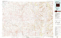
1979 Map of Nowater Creek
USGS Topo · Published 1980About this map
Nowater Creek and its many seasonal tributaries dominate this high-desert drainage basin during the late 1970s. The landscape is defined by vast erosion patterns and intermittent water sources, where names like Dry Vee Slough and Slick Creek suggest the aridity of the Wyoming interior. Human activity is largely industrial and agricultural, evidenced by the scattered Oil Field developments and the presence of the Burlington Northern railroad corridor. Toward the edges of the survey, the terrain rises sharply into the Bighorn Mountains and Bridger Mountains, where prominent landmarks such as Castle Gardens and Zimmerman Buttes break the horizon. Small outposts and agricultural operations like Nowood and the Hampton Ranch provide the only significant markers of residential settlement in this sparse, ranching-driven territory.
Find a feature on this map
49 named features on this map. Tap any name to fly to it.
Don’t see what you’re looking for? This feature index may not catch every label — zoom into the map to look around manually.
Map Details
Editions of this 1979 Nowater Creek Map
This is the sole edition of this map. No revisions or reprints were ever made.
Other maps of this area

1899 · Cloud peak
USGS Topo · 1:125,000

1900 · Fort McKinney
USGS Topo · 1:125,000

1901 · Cloud Peak
USGS Topo · 1:125,000

1903 · Fort McKinney
USGS Topo · 1:125,000

1945 · Kirby
USGS Topo · 1:62,500

1946 · Kirby
USGS Topo · 1:62,500

1951 · Birdseye Pass
USGS Topo · 1:24,000

1951 · Schuster Flats SE
USGS Topo · 1:24,000

1952 · Cottonwood Pass
USGS Topo · 1:24,000

1952 · Rathbun Ranch
USGS Topo · 1:24,000