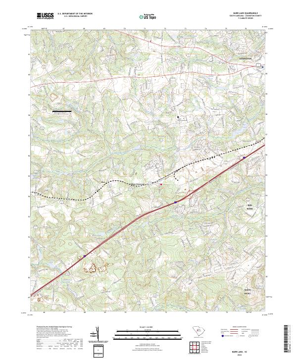
2024 Map of Barr Lake
USGS Topo · Published 2024About this map
Lexington and its surrounding rural corridors appear in high detail on this contemporary survey, showing the expansion of the county seat south toward Red Bank and White Knoll. The landscape is defined by the complex drainage of Twelvemile Creek, Red Bank Creek, and Congaree Creek, which feed a series of established water bodies including Barr Lake and Gibsons Pond. For genealogists and local historians, the inclusion of Pisgah Church Graveyard provides a critical point of reference for family research in this part of the Midlands. The transition from the dense street grids of the north to the more scattered settlements of Elsie and Ethon Crossroads illustrates the region's evolving land use. Small aviation infrastructure like Whiteplains Airport and numerous private water features like Taylor Millpond and Zimmerman Pond reflect the modern suburban-rural character of Lexington County today.
Find a feature on this map
225 named features on this map. Tap any name to fly to it.
Don’t see what you’re looking for? This feature index may not catch every label — zoom into the map to look around manually.
Map Details
Editions of this 2024 Barr Lake Map
This is the sole edition of this map. No revisions or reprints were ever made.
Other maps of this area

1904 · Columbia
USGS Topo · 1:125,000

1941 · Spartanburg
USGS Topo · 1:250,000

1944 · Gilbert
USGS Topo · 1:62,500

1944 · Edmund
USGS Topo · 1:62,500

1946 · Irmo
USGS Topo · 1:24,000

1948 · Irmo
USGS Topo · 1:24,000

1953 · Spartanburg
USGS Topo · 1:250,000

1954 · Augusta
USGS Topo · 1:250,000

1957 · Augusta
USGS Topo · 1:250,000

1958 · Augusta
USGS Topo · 1:250,000