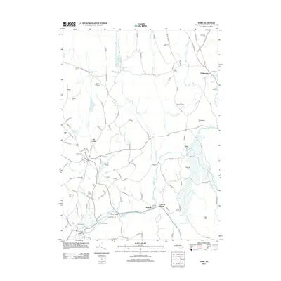
2012 Map of Barre
USGS Topo · Published 2012About this map
The Ware River and its various tributaries, including the Burnshirt River and Prince River, define the industrial and agricultural layout of this central Massachusetts landscape. Numerous small settlements such as Williamsville, Heald Village, and Coldbrook Springs are clustered near these waterways, which once powered the region's early mills. Evidence of the area's developed infrastructure is visible in the B & M RR corridor and the significant engineering of the Barre Falls Dam.
Find a feature on this map
137 named features on this map. Tap any name to fly to it.
Don’t see what you’re looking for? This feature index may not catch every label — zoom into the map to look around manually.
Map Details
Editions of this 2012 Barre Map
This is the sole edition of this map. No revisions or reprints were ever made.
Other maps of this area

1885 · Worcester
USGS Topo · 1:62,500

1886 · Worcester
USGS Topo · 1:62,500

1887 · Winchendon
USGS Topo · 1:62,500

1887 · Barre
USGS Topo · 1:62,500

1887 · Fitchburg
USGS Topo · 1:62,500

1889 · Fitchburg
USGS Topo · 1:62,500

1889 · Barre
USGS Topo · 1:62,500

1890 · Winchendon
USGS Topo · 1:62,500

1892 · Worcester
USGS Topo · 1:62,500

1893 · Fitchburg
USGS Topo · 1:62,500