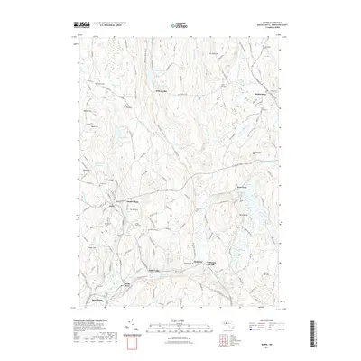
2021 Map of Barre
USGS Topo · Published 2021About this map
The Ware River flows through a series of clustered mill villages and hamlets in this central Massachusetts landscape. Modern recreational paths now follow the corridors of the historic rail network, with the Ware River Valley Rail Trl and the Mass Central Rail Trl cutting through the terrain. The map documents numerous distinct settlements such as Heald Village, Mill Village, and White Valley, alongside the larger hubs of Barre and Hubbardston.
Find a feature on this map
149 named features on this map. Tap any name to fly to it.
Don’t see what you’re looking for? This feature index may not catch every label — zoom into the map to look around manually.
Map Details
Editions of this 2021 Barre Map
This is the sole edition of this map. No revisions or reprints were ever made.
Other maps of this area

1885 · Worcester
USGS Topo · 1:62,500

1886 · Worcester
USGS Topo · 1:62,500

1887 · Winchendon
USGS Topo · 1:62,500

1887 · Barre
USGS Topo · 1:62,500

1887 · Fitchburg
USGS Topo · 1:62,500

1889 · Fitchburg
USGS Topo · 1:62,500

1889 · Barre
USGS Topo · 1:62,500

1890 · Winchendon
USGS Topo · 1:62,500

1892 · Worcester
USGS Topo · 1:62,500

1893 · Fitchburg
USGS Topo · 1:62,500