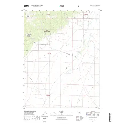
2018 Map of Barrett Canyon
USGS Topo · Published 2018About this map
The Shoshone Mountains dominate the western horizon of this Nye County landscape, where the high-elevation terrain of the Toiyabe National Forest gives way to the broad valley of the Reese River. This 2018 survey reveals a network of canyons and drainages, such as Barrett Canyon and Waterfall Canyon, that define the hydrological character of the range. Evidence of human activity is centered on ranching and early mineral exploration, notably the O'Toole Ranch Airport and the Becker Adits tucked into the mountain slopes. Transportation across this arid basin is facilitated by the Ione Rd, which tracks the general course of the river, while specialized access points like the Becker Canyon Bypass and Barrett Canyon War Eagle indicate the specific navigational needs of this high-desert environment.
Find a feature on this map
31 named features on this map. Tap any name to fly to it.
Don’t see what you’re looking for? This feature index may not catch every label — zoom into the map to look around manually.
Map Details
Editions of this 2018 Barrett Canyon Map
This is the sole edition of this map. No revisions or reprints were ever made.
Other maps of this area

1907 · Tonopah
USGS Topo · 1:250,000

1908 · Tonopah
USGS Topo · 1:250,000

1948 · Ione
USGS Topo · 1:62,500

1950 · Ione
USGS Topo · 1:62,500

1955 · Millett
USGS Topo · 1:250,000

1956 · South Shoshone Peak
USGS Topo · 1:62,500

1956 · North Shoshone Peak
USGS Topo · 1:62,500

1956 · Tonopah
USGS Topo · 1:250,000

1959 · Tonopah
USGS Topo · 1:250,000

1959 · Millett
USGS Topo · 1:250,000