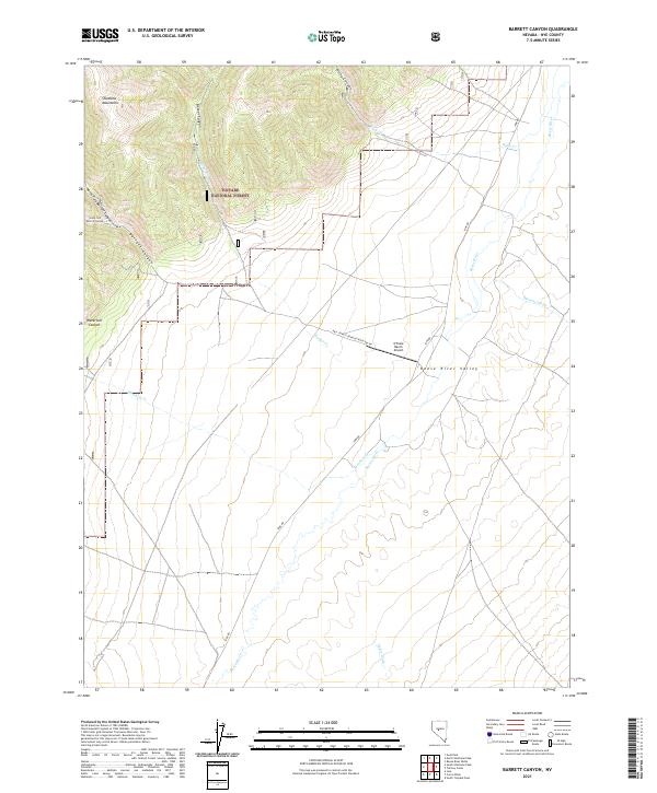
2021 Map of Barrett Canyon
USGS Topo · Published 2021About this map
The Shoshone Mountains dominate the western horizon of this high-desert landscape within the Toiyabe National Forest. This 2021 survey details the drainage systems where the North Fork Barrett Canyon and South Fork Barrett Canyon converge to form Barrett Canyon, cutting through the steep terrain toward the Reese River Valley. The mapping reveals a distinct transition from the high-elevation forest and narrow defiles like Waterfall Canyon to the broad alluvial plain of the east.
Find a feature on this map
23 named features on this map. Tap any name to fly to it.
Don’t see what you’re looking for? This feature index may not catch every label — zoom into the map to look around manually.
Map Details
Editions of this 2021 Barrett Canyon Map
This is the sole edition of this map. No revisions or reprints were ever made.
Other maps of this area

1907 · Tonopah
USGS Topo · 1:250,000

1908 · Tonopah
USGS Topo · 1:250,000

1948 · Ione
USGS Topo · 1:62,500

1950 · Ione
USGS Topo · 1:62,500

1955 · Millett
USGS Topo · 1:250,000

1956 · South Shoshone Peak
USGS Topo · 1:62,500

1956 · North Shoshone Peak
USGS Topo · 1:62,500

1956 · Tonopah
USGS Topo · 1:250,000

1959 · Tonopah
USGS Topo · 1:250,000

1959 · Millett
USGS Topo · 1:250,000