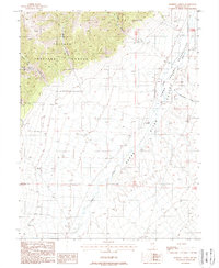
1988 Map of Barrett Canyon
USGS Topo · Published 1988About this map
The Reese River valley defines this high-desert landscape in central Nevada, where the watercourse snakes between the steep slopes of the Toiyabe National Forest and the Yomba Indian Reservation. This 1980s provisional survey shows the traditional ranching and indigenous lands that characterize the region. Notable landmarks include the O'Toole Ranch situated near the river, and several deep drainage features like Barrett Canyon and Riley Canyon that feed the valley floor from the western mountains. The map captures the remote character of the area, punctuated only by a few unimproved roads and small creeks such as Marysville Creek. The presence of Becker Canyon and Waterfall Can indicates the complex topography of the Shoshone Mountains' eastern flank, providing a detailed record of the terrain as it appeared in the late twentieth century.
Find a feature on this map
16 named features on this map. Tap any name to fly to it.
Don’t see what you’re looking for? This feature index may not catch every label — zoom into the map to look around manually.
Map Details
Editions of this 1988 Barrett Canyon Map
This is the sole edition of this map. No revisions or reprints were ever made.
Other maps of this area

1907 · Tonopah
USGS Topo · 1:250,000

1908 · Tonopah
USGS Topo · 1:250,000

1948 · Ione
USGS Topo · 1:62,500

1950 · Ione
USGS Topo · 1:62,500

1955 · Millett
USGS Topo · 1:250,000

1956 · South Shoshone Peak
USGS Topo · 1:62,500

1956 · North Shoshone Peak
USGS Topo · 1:62,500

1956 · Tonopah
USGS Topo · 1:250,000

1959 · Tonopah
USGS Topo · 1:250,000

1959 · Millett
USGS Topo · 1:250,000