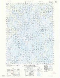
1962 Map of Barrow A-4
USGS Topo · Published 1962About this map
Naval Petroleum Reserve No 4 dominates this 1962 landscape of the North Slope, revealing a territory defined by remote industrial exploration and a complex hydrology of thaw lakes. The terrain is characterized by large, elongated water bodies such as Ikroavik Lake, Lake Sungovoak, and Sikulik Lake, which are interconnected by seasonal drainages like Aluik Creek. Grounded in the early Cold War era of resource scouting, the map highlights localized energy infrastructure including the Gas well No 3 (abandoned). Transportation across this marshy tundra was limited to a sparse network of Tractor Trails, reflecting the specialized machinery required to navigate the soft ground and deposits of Mud during the short summer months or the frozen winter cycle.
Find a feature on this map
9 named features on this map. Tap any name to fly to it.
Don’t see what you’re looking for? This feature index may not catch every label — zoom into the map to look around manually.
Map Details
Editions of this 1962 Barrow A-4 Map
This is the sole edition of this map. No revisions or reprints were ever made.
Other maps of this area

1945 · Barrow
USGS Topo · 1:250,000

1949 · Barrow
USGS Topo · 1:250,000

1951 · Meade River
USGS Topo · 1:250,000

1955 · Barrow
USGS Topo · 1:250,000

1955 · Barrow B-4
USGS Topo · 1:63,360

1955 · Meade River
USGS Topo · 1:250,000

1955 · Barrow A-4
USGS Topo · 1:63,360

1955 · Barrow A-5
USGS Topo · 1:63,360

1955 · Barrow A-3
USGS Topo · 1:63,360

1955 · Meade River D-2
USGS Topo · 1:63,360