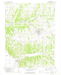
1978 Map of Barry
USGS Topo · Published 1978About this map
Barry serves as the focal point of this west-central Illinois landscape, where the Norfolk and Western railroad cuts a diagonal path through the township divisions of Hadley and Pleasant Vale. The terrain is defined by a dense network of drainage hollows, including Grubb Hollow and Horn Hollow, which feed into larger watercourses like Hadley Creek and Kiser Creek. This intricate topography influenced the placement of early infrastructure and small rural settlements like New Canton and El Dara at the southwestern and southeastern corners of the survey.
Find a feature on this map
29 named features on this map. Tap any name to fly to it.
Don’t see what you’re looking for? This feature index may not catch every label — zoom into the map to look around manually.
Map Details
Editions of this 1978 Barry Map
This is the sole edition of this map. No revisions or reprints were ever made.
Other maps of this area

1925 · Liberty
USGS Topo · 1:62,500

1926 · Pittsfield
USGS Topo · 1:62,500

1926 · Mt Sterling
USGS Topo · 1:62,500

1927 · Liberty
USGS Topo · 1:62,500

1929 · Mt Sterling
USGS Topo · 1:62,500

1931 · Barry
USGS Topo · 1:62,500

1936 · Barry
USGS Topo · 1:48,000

1944 · Barry
USGS Topo · 1:62,500

1948 · Quincy
USGS Topo · 1:250,000

1956 · Quincy
USGS Topo · 1:250,000