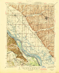
1944 Map of Barry
USGS Topo · Published 1944About this map
Cincinnati Landing and the La Motte Reservation anchor this stretch of the Mississippi River floodplain during the mid-1940s. The landscape is defined by an intricate network of sloughs and chutes, including Swain Slough and Jim Young Chute, which cut through a complex of river islands such as Gilbert Island and Denmark Island. This survey illustrates the vital relationship between the river valley and the uplands, where the Wabash Railroad serves settlements like Barry and Kinderhook.
Find a feature on this map
134 named features on this map. Tap any name to fly to it.
Don’t see what you’re looking for? This feature index may not catch every label — zoom into the map to look around manually.
Map Details
Editions of this 1944 Barry Map
2 editions found

Other maps of this area

1890 · Louisiana
USGS Topo · 1:125,000

1925 · Quincy
USGS Topo · 1:62,500

1925 · Liberty
USGS Topo · 1:62,500

1926 · Pittsfield
USGS Topo · 1:62,500

1926 · Mt Sterling
USGS Topo · 1:62,500

1927 · Liberty
USGS Topo · 1:62,500

1929 · Mt Sterling
USGS Topo · 1:62,500

1930 · Nebo
USGS Topo · 1:62,500

1931 · Barry
USGS Topo · 1:62,500

1932 · Hannibal
USGS Topo · 1:62,500