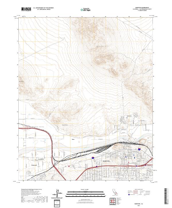
2021 Map of Barstow
USGS Topo · Published 2021About this map
The city of Barstow serves as a critical junction in the high desert, where the Mojave River valley meets the transit corridors of the Hinkley Valley. This contemporary survey reveals a complex urban and industrial footprint, stretching from the central core near the San Bernardino County Barstow District Courthouse to the western neighborhoods of Lenwood and Grandview. The landscape is dominated by the dry riverbed and the surrounding mountain ranges, including the Waterman Hills to the north and the Mitchel Range to the east. Modern residential growth is evident in the street grids extending toward B Hill, while the outlying settlement of Hutt remains a distinct marker along the rail and highway lines. This map documents the intersection of natural desert topography, such as the Mojave Desert floor, with the intensive infrastructure required for a regional logistics and transportation hub.
Find a feature on this map
125 named features on this map. Tap any name to fly to it.
Don’t see what you’re looking for? This feature index may not catch every label — zoom into the map to look around manually.
Map Details
Editions of this 2021 Barstow Map
This is the sole edition of this map. No revisions or reprints were ever made.
Other maps of this area

1915 · Searles Lake
USGS Topo · 1:250,000

1932 · Barstow
USGS Topo · 1:125,000

1933 · Avawatz Mountains
USGS Topo · 1:250,000

1934 · Barstow
USGS Topo · 1:125,000

1947 · Trona
USGS Topo · 1:250,000

1948 · Trona
USGS Topo · 1:250,000

1948 · Lane Mountain
USGS Topo · 1:62,500

1951 · Lane Mountain
USGS Topo · 1:62,500

1953 · San Bernardino
USGS Topo · 1:250,000

1953 · Trona
USGS Topo · 1:250,000