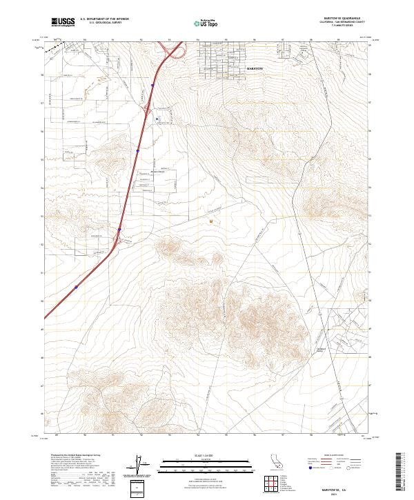
2021 Map of Barstow SE
USGS Topo · Published 2021About this map
Barstow serves as the focal point for this high-desert landscape, where the southern reaches of the city meet the expanse of the Mojave Desert. The map reveals a transition from the structured residential and educational campus at Barstow Community College to an increasingly commercial and industrial corridor. Transportation infrastructure heavily influences the layout of the land, with major arteries like Lenwood Rd and Commerce Pkwy supporting local logistics and commerce. Further south, the terrain opens into Stoddard Valley, characterized by a sparse network of roads like Maloof Ave and Harmony Ave that push into the desert floor. This 2021 survey illustrates the modern footprint of the region, balancing the urban needs of San Bernardino County with the natural topography of the valley floor.
Find a feature on this map
78 named features on this map. Tap any name to fly to it.
Don’t see what you’re looking for? This feature index may not catch every label — zoom into the map to look around manually.
Map Details
Editions of this 2021 Barstow SE Map
This is the sole edition of this map. No revisions or reprints were ever made.
Other maps of this area

1932 · Barstow
USGS Topo · 1:125,000

1934 · Barstow
USGS Topo · 1:125,000

1953 · San Bernardino
USGS Topo · 1:250,000
1953 · Nebo
USGS Topo · 1:24,000

1955 · Ord Mountains
USGS Topo · 1:62,500

1956 · San Bernardino
USGS Topo · 1:250,000

1956 · Daggett
USGS Topo · 1:62,500

1956 · Barstow
USGS Topo · 1:62,500

1957 · Apple Valley
USGS Topo · 1:62,500

1957 · San Bernardino
USGS Topo · 1:250,000