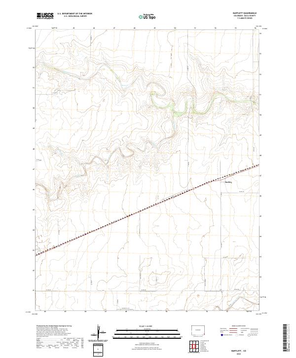
2022 Map of Bartlett
USGS Topo · Published 2022About this map
The small settlement of Bartlett serves as the focal point of this Baca County landscape, situated along a primary roadway in the southeastern corner of Colorado. The terrain is defined by a dendritic network of seasonal drainages, most notably Horse Cr and Bear Creek, which wind through the township divisions of the High Plains. This 2022 survey illustrates a region dominated by agricultural grid systems, with an extensive network of rural routes such as Co Rd GG and Co Rd DD providing access across the sections. The presence of Muddy Cr and Buck Creek further characterizes the local hydrology, marking the subtle depressions and drainage patterns that have influenced land use and settlement in this corner of the state for generations.
Find a feature on this map
27 named features on this map. Tap any name to fly to it.
Don’t see what you’re looking for? This feature index may not catch every label — zoom into the map to look around manually.
Map Details
Editions of this 2022 Bartlett Map
This is the sole edition of this map. No revisions or reprints were ever made.
Other maps of this area

1891 · Albany
USGS Topo · 1:125,000

1892 · Vilas
USGS Topo · 1:125,000

1893 · Albany
USGS Topo · 1:125,000

1955 · La Junta
USGS Topo · 1:250,000

1958 · La Junta
USGS Topo · 1:250,000

1968 · La Junta
USGS Topo · 1:250,000
1971 · Lycan SE
USGS Topo · 1:24,000

1971 · Two Buttes SE
USGS Topo · 1:24,000
1971 · Lycan
USGS Topo · 1:24,000

1978 · Walsh SE
USGS Topo · 1:24,000