
1978 Map of Walsh SE
USGS Topo · Published 1978About this map
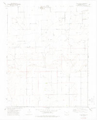
Boston Cem serves as a silent landmark in the southwest corner of this landscape, a point of significant interest for genealogists tracing early families in this part of Baca County. The terrain is defined by the ephemeral drainage of Sand Arroyo and the seasonal path of Dry Creek, illustrating the arid conditions that shaped regional ranching and agricultural practices. By the late 1970s, the area was heavily characterized by energy exploration and resource extraction, evidenced by a dense network of Gas Well sites, scattered Oil Well locations, and a dedicated Pumping Sta. This distribution of infrastructure alongside traditional landmarks like the cemetery highlights the shift from early prairie settlement toward a specialized industrial landscape focused on the subterranean resources of the High Plains.
Find a feature on this map
9 named features on this map. Tap any name to fly to it.
Don’t see what you’re looking for? This feature index may not catch every label — zoom into the map to look around manually.
Map Details
Editions of this 1978 Walsh SE Map
This is the sole edition of this map. No revisions or reprints were ever made.
Other maps of this area

1892 · Vilas
USGS Topo · 1:125,000

1955 · La Junta
USGS Topo · 1:250,000

1958 · La Junta
USGS Topo · 1:250,000

1968 · La Junta
USGS Topo · 1:250,000
1978 · Midway
USGS Topo · 1:24,000
1978 · Walsh
USGS Topo · 1:24,000

1978 · Moore Draw NE
USGS Topo · 1:24,000
1978 · Vilas North
USGS Topo · 1:24,000
1978 · Bartlett
USGS Topo · 1:24,000
1978 · Vilas South
USGS Topo · 1:24,000