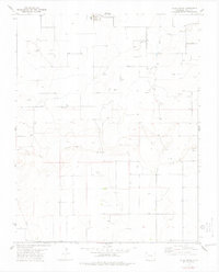
1978 Map of Vilas South
USGS Topo · Published 1979About this map
Vilas sits at the northern edge of this high plains landscape, anchoring a rural grid defined by agricultural and energy development in the late 1970s. The terrain is marked by the intermittent drainage of Dry Creek and the broader sweep of Sand Arroyo as they cut through the section lines of Baca County. This 1978 survey highlights the infrastructure of the local economy, ranging from the Cottrell site to a widespread network of Gas Wells and an Oil Well. A prominent Pipeline and a central Pumping Sta underscore the industrial shift towards subsurface resource extraction during this period. For those tracing the evolution of southeastern Colorado, the map records numerous Wells and an occasional Drill Hole, illustrating the systematic search for water and energy resources across this semi-arid region.
Find a feature on this map
11 named features on this map. Tap any name to fly to it.
Don’t see what you’re looking for? This feature index may not catch every label — zoom into the map to look around manually.
Map Details
Editions of this 1978 Vilas South Map
This is the sole edition of this map. No revisions or reprints were ever made.
Other maps of this area

1891 · Springfield
USGS Topo · 1:125,000

1892 · Vilas
USGS Topo · 1:125,000

1893 · Springfield
USGS Topo · 1:125,000

1955 · La Junta
USGS Topo · 1:250,000

1958 · La Junta
USGS Topo · 1:250,000

1968 · La Junta
USGS Topo · 1:250,000

1978 · Walsh SE
USGS Topo · 1:24,000
1978 · Walsh
USGS Topo · 1:24,000

1978 · Moore Draw NE
USGS Topo · 1:24,000

1978 · Campo NE
USGS Topo · 1:24,000