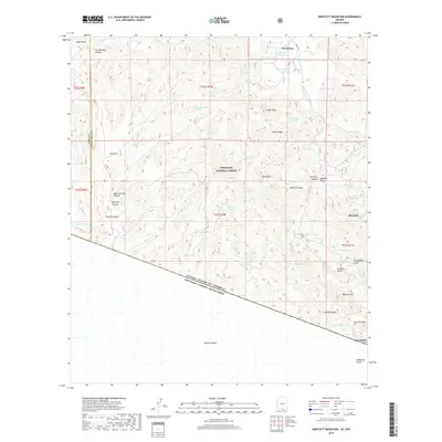
2018 Map of Bartlett Mountain
USGS Topo · Published 2018About this map
The United States of America Estados Unidos Mexicanos international border defines the southern edge of this quadrangle, where the high desert terrain of Santa Cruz County meets the Mexican frontier. The landscape is marked by the mining and ranching heritage of the Oro Blanco district, including the namesake settlement and the Old Glory mine and settlement to the southeast. Steep drainages like California Gulch, Scribner Gulch, and Tres Amigos Gulch cut through the foothills of Bartlett Mtn and Cobre Mtn, illustrating the complex topography that once drew prospectors to these canyons. Numerous water features, such as Cemetery Tank near El Oro Cem and Japanese Tank in Japanese Valley, signify the vital infrastructure required for survival and industry in this arid environment. The map also traces the Pima Co Santa Cruz Co line as it traverses the western ridges near Cañoncito.
Find a feature on this map
46 named features on this map. Tap any name to fly to it.
Don’t see what you’re looking for? This feature index may not catch every label — zoom into the map to look around manually.
Map Details
Editions of this 2018 Bartlett Mountain Map
This is the sole edition of this map. No revisions or reprints were ever made.
Other maps of this area

1920 · Arivaca
USGS Topo · 1:125,000

1921 · Old Glory
USGS Topo · 1:125,000

1939 · Tubac
USGS Topo · 1:62,500

1941 · Arivaca
USGS Topo · 1:62,500

1942 · Ruby
USGS Topo · 1:62,500

1942 · Oro Blanco
USGS Topo · 1:62,500

1943 · Arivaca
USGS Topo · 1:62,500

1943 · Old Glory
USGS Topo · 1:125,000

1943 · Tubac
USGS Topo · 1:62,500

1944 · Oro Blanco
USGS Topo · 1:62,500