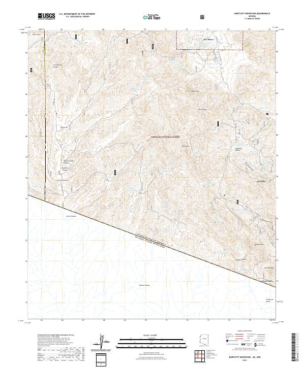
2021 Map of Bartlett Mountain
USGS Topo · Published 2021About this map
Oro Blanco and Old Glory sit at the center of this high-desert survey, which documents the complex terrain of the Coronado National Forest just north of the international boundary. The landscape is defined by its water management strategy, where numerous named tanks such as Cemetery Tank and Warsaw Tank supported cattle and mining operations in an arid climate. To the south, the diagonal line of the United States of America Estados Unidos Mexicanos border cuts across deep drainages like Bonita Canyon, creating a sharp geopolitical boundary in a continuous wilderness of ridges and washes. The presence of Casa Piedra near the border highlights the historic routes and small outposts that once connected this remote region of Santa Cruz County to the larger territory. Geographic features like Bartlett Mtn and Cobre Mtn provide the vertical relief for a network of gulches and canyons including Scribner Gulch and California Gulch.
Find a feature on this map
61 named features on this map. Tap any name to fly to it.
Don’t see what you’re looking for? This feature index may not catch every label — zoom into the map to look around manually.
Map Details
Editions of this 2021 Bartlett Mountain Map
This is the sole edition of this map. No revisions or reprints were ever made.
Other maps of this area

1920 · Arivaca
USGS Topo · 1:125,000

1921 · Old Glory
USGS Topo · 1:125,000

1939 · Tubac
USGS Topo · 1:62,500

1941 · Arivaca
USGS Topo · 1:62,500

1942 · Ruby
USGS Topo · 1:62,500

1942 · Oro Blanco
USGS Topo · 1:62,500

1943 · Arivaca
USGS Topo · 1:62,500

1943 · Old Glory
USGS Topo · 1:125,000

1943 · Tubac
USGS Topo · 1:62,500

1944 · Oro Blanco
USGS Topo · 1:62,500