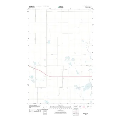
2011 Map of Bartlett
USGS Topo · Published 2011About this map
Bartlett centers this prairie landscape, situated along a prominent east-west transportation corridor. The settlement's layout is defined by a grid of rural sections, with local life historically connected to the nearby water bodies of Twin Lakes to the west and Jones Lake to the southeast. The area's agricultural character is reflected in the extensive network of township roads, such as 49th ST Ne and 100th Ave Ne, which segment the terrain into precise tracts. In the southern portion of the quadrangle, Rose Lake provides another natural landmark within this northern plains environment. The map details the transition between these wetland features and the organized road system of Ramsey County as it existed in the early 21st century.
Find a feature on this map
21 named features on this map. Tap any name to fly to it.
Don’t see what you’re looking for? This feature index may not catch every label — zoom into the map to look around manually.
Map Details
Editions of this 2011 Bartlett Map
This is the sole edition of this map. No revisions or reprints were ever made.
Other maps of this area

1930 · Pekin
USGS Topo · 1:62,500

1930 · Hamar
USGS Topo · 1:62,500

1950 · Devils Lake Mountain
USGS Topo · 1:24,000

1951 · Pekin NE
USGS Topo · 1:24,000

1951 · Devils Lake Mountain
USGS Topo · 1:24,000

1951 · Pekin NW
USGS Topo · 1:24,000

1951 · Pekin
USGS Topo · 1:62,500

1952 · New Rockford
USGS Topo · 1:250,000

1953 · Devils Lake
USGS Topo · 1:250,000

1956 · New Rockford
USGS Topo · 1:250,000