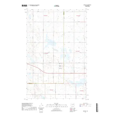
2017 Map of Bartlett
USGS Topo · Published 2017About this map
Bartlett centers this high-plains landscape, situated along the border of Ramsey Co Nelson Co. The settlement’s history is anchored by its local burial grounds, the Bartlett Village Cem and Bartlett Protestant Cem, which serve as vital landmarks for genealogical research in this rural pocket of North Dakota. The surrounding terrain is defined by its glacial prairie potholes and scattered water bodies, including Twin Lakes to the west and Jones Lake to the southeast. A grid of section-line roads, such as 44th St NE and Co Hwy 2, connects the isolated farmsteads across the township divisions of t153n r61w and t153n r60w. The presence of the Prairie Trl in the northern reaches suggests the enduring nature of regional transport routes across this agricultural expanse.
Find a feature on this map
26 named features on this map. Tap any name to fly to it.
Don’t see what you’re looking for? This feature index may not catch every label — zoom into the map to look around manually.
Map Details
Editions of this 2017 Bartlett Map
This is the sole edition of this map. No revisions or reprints were ever made.
Other maps of this area

1930 · Pekin
USGS Topo · 1:62,500

1930 · Hamar
USGS Topo · 1:62,500

1950 · Devils Lake Mountain
USGS Topo · 1:24,000

1951 · Pekin NE
USGS Topo · 1:24,000

1951 · Devils Lake Mountain
USGS Topo · 1:24,000

1951 · Pekin NW
USGS Topo · 1:24,000

1951 · Pekin
USGS Topo · 1:62,500

1952 · New Rockford
USGS Topo · 1:250,000

1953 · Devils Lake
USGS Topo · 1:250,000

1956 · New Rockford
USGS Topo · 1:250,000