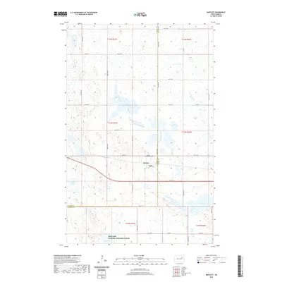
2020 Map of Bartlett
USGS Topo · Published 2020About this map
Bartlett stands at the center of this landscape, positioned along the boundary of Ramsey Co and Nelson Co. The settlement's history is anchored by its two burial grounds, the Bartlett Protestant Cem and the Bartlett Village Cem, which serve as vital markers for local genealogical research. To the south, the terrain transitions into the protected wetlands of the Rose Lake National Wildlife Refuge, where the waters of Rose Lake and nearby Twin Lakes dominate the prairie landscape.
Find a feature on this map
31 named features on this map. Tap any name to fly to it.
Don’t see what you’re looking for? This feature index may not catch every label — zoom into the map to look around manually.
Map Details
Editions of this 2020 Bartlett Map
This is the sole edition of this map. No revisions or reprints were ever made.
Other maps of this area

1930 · Pekin
USGS Topo · 1:62,500

1930 · Hamar
USGS Topo · 1:62,500

1950 · Devils Lake Mountain
USGS Topo · 1:24,000

1951 · Pekin NE
USGS Topo · 1:24,000

1951 · Devils Lake Mountain
USGS Topo · 1:24,000

1951 · Pekin NW
USGS Topo · 1:24,000

1951 · Pekin
USGS Topo · 1:62,500

1952 · New Rockford
USGS Topo · 1:250,000

1953 · Devils Lake
USGS Topo · 1:250,000

1956 · New Rockford
USGS Topo · 1:250,000