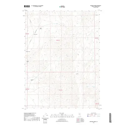
2018 Map of Bartomes Spring
USGS Topo · Published 2018About this map
The East Range dominates this Pershing County landscape, defined by high-altitude terrain and narrow watercourses that feed the desert basins below. In the northeast, the broad profile of Table Mtn overlooks several seasonal drainages, including Sooner Cr and Marble Cr. The terrain is deeply incised by a series of prominent canyons, most notably Sulphur Canyon and Leach Canyon in the northwest.
Find a feature on this map
24 named features on this map. Tap any name to fly to it.
Don’t see what you’re looking for? This feature index may not catch every label — zoom into the map to look around manually.
Map Details
Editions of this 2018 Bartomes Spring Map
This is the sole edition of this map. No revisions or reprints were ever made.
Other maps of this area

1932 · Sonoma Range
USGS Topo · 1:250,000

1939 · Sonoma Range
USGS Topo · 1:250,000

1955 · Winnemucca
USGS Topo · 1:250,000

1958 · Winnemucca
USGS Topo · 1:250,000
1961 · Kyle Hot Springs
USGS Topo · 1:62,500

1961 · Mt. Tobin
USGS Topo · 1:62,500

1961 · Leach Hot Springs
USGS Topo · 1:62,500

1961 · Dun Glen
USGS Topo · 1:62,500

1962 · Winnemucca
USGS Topo · 1:250,000

1982 · Fish Creek Mts
USGS Topo · 1:100,000