
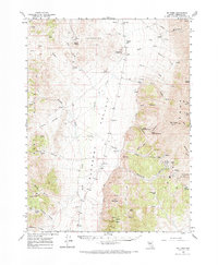
1961 Map of Mt. Tobin
USGS Topo · Published 1963About this map
Gold Banks Hills and the massive Mt Tobin Range dominate this Nevada landscape, where high-altitude mining and ranching define the human presence. Evidence of past industry is found at the Goldbanks (Site), marked by nearby furnaces and a Goldbanks Windmill, and at the former town of Kennedy (Site) in the East Range. The central corridor of Pleasant Valley provides a stark contrast to the surrounding peaks, home to the Pearce Sch and critical water sources like Ringling Well.
Find a feature on this map
59 named features on this map. Tap any name to fly to it.
Don’t see what you’re looking for? This feature index may not catch every label — zoom into the map to look around manually.
Map Details
Editions of this 1961 Mt. Tobin Map
2 editions found
Other maps of this area

1932 · Sonoma Range
USGS Topo · 1:250,000

1939 · Sonoma Range
USGS Topo · 1:250,000

1955 · Winnemucca
USGS Topo · 1:250,000

1958 · Winnemucca
USGS Topo · 1:250,000
1961 · Kyle Hot Springs
USGS Topo · 1:62,500

1961 · Cain Mountain
USGS Topo · 1:62,500

1961 · Leach Hot Springs
USGS Topo · 1:62,500

1961 · Fencemaker
USGS Topo · 1:62,500

1961 · Dun Glen
USGS Topo · 1:62,500

1961 · Mt. Moses
USGS Topo · 1:62,500