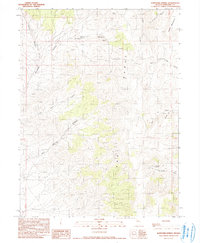
1990 Map of Bartomes Spring
USGS Topo · Published 1990About this map
Bartomes Spring and the East Range mountains dominate this Pershing County landscape, recorded during a 1988 field check. The area is defined by its water sources and mining potential, with Sulphur Spring and Hot Spring providing critical water in a series of deep canyons. These drainages, including Leach Canyon and Lone Pine Canyon, carve through the high desert terrain toward the eastern boundary at Table Mountain.
Find a feature on this map
19 named features on this map. Tap any name to fly to it.
Don’t see what you’re looking for? This feature index may not catch every label — zoom into the map to look around manually.
Map Details
Editions of this 1990 Bartomes Spring Map
This is the sole edition of this map. No revisions or reprints were ever made.
Other maps of this area

1932 · Sonoma Range
USGS Topo · 1:250,000

1939 · Sonoma Range
USGS Topo · 1:250,000

1955 · Winnemucca
USGS Topo · 1:250,000

1958 · Winnemucca
USGS Topo · 1:250,000
1961 · Kyle Hot Springs
USGS Topo · 1:62,500

1961 · Mt. Tobin
USGS Topo · 1:62,500

1961 · Leach Hot Springs
USGS Topo · 1:62,500

1961 · Dun Glen
USGS Topo · 1:62,500

1962 · Winnemucca
USGS Topo · 1:250,000

1982 · Fish Creek Mts
USGS Topo · 1:100,000