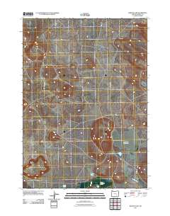
2011 Map of Barton Lake
USGS Topo · Published 2011About this map
Dry Lake Reservoir and Barton Lake anchor this 2011 topgraphic survey of Harney County, illustrating the hydraulic infrastructure essential to Oregon's high desert ranching economy. The map centers on the Barton Ranch and its associated Barton Lake Ranch Airstrip, highlighting the reliance on private aviation in this sparsely populated basin. The landscape is defined by the management of intermittent water sources, shown through the Highline Ditch, Feed Canal, and Riddle Creek. A distinct lack of dense settlement reveals a region dedicated to livestock and resource management, with Lava Beds Rd serving as a primary transit line through the sagebrush-dominated terrain. To the southwest, White Lake marks another focal point of the area's basin-and-range hydrology.
Find a feature on this map
9 named features on this map. Tap any name to fly to it.
Don’t see what you’re looking for? This feature index may not catch every label — zoom into the map to look around manually.
Map Details
Editions of this 2011 Barton Lake Map
This is the sole edition of this map. No revisions or reprints were ever made.
Other maps of this area

1955 · Burns
USGS Topo · 1:250,000

1958 · Burns
USGS Topo · 1:250,000

1959 · Burns
USGS Topo · 1:250,000

1959 · Lawen
USGS Topo · 1:62,500

1960 · Crane
USGS Topo · 1:62,500

1967 · Happy Valley
USGS Topo · 1:24,000

1967 · Jackass Butte NE
USGS Topo · 1:24,000

1967 · Barton Lake
USGS Topo · 1:24,000
1967 · Diamond Swamp
USGS Topo · 1:24,000

1967 · Diamond
USGS Topo · 1:24,000