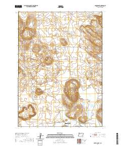
2020 Map of Barton Lake
USGS Topo · Published 2020About this map
Barton Lake and the volcanic landscape of Diamond Craters define this high desert portion of Harney County. The map details a complex water management system essential for ranching in this arid environment, featuring the Highline Ditch, Feed Canal, and the Dry Lake Reservoir. These man-made features interact with natural drainages like Riddle Cr to support local agricultural operations. The inclusion of the Barton Lake Ranch Airport suggests the importance of aerial access for large-scale land management in this isolated region. Topographic contours illustrate the unique geological formations of the crater area, while a network of rural routes including Diamond Loop Rd and Diamond Craters Rd provide the primary infrastructure through the basin.
Find a feature on this map
14 named features on this map. Tap any name to fly to it.
Don’t see what you’re looking for? This feature index may not catch every label — zoom into the map to look around manually.
Map Details
Editions of this 2020 Barton Lake Map
This is the sole edition of this map. No revisions or reprints were ever made.
Other maps of this area

1955 · Burns
USGS Topo · 1:250,000

1958 · Burns
USGS Topo · 1:250,000

1959 · Burns
USGS Topo · 1:250,000

1959 · Lawen
USGS Topo · 1:62,500

1960 · Crane
USGS Topo · 1:62,500

1967 · Happy Valley
USGS Topo · 1:24,000

1967 · Jackass Butte NE
USGS Topo · 1:24,000

1967 · Barton Lake
USGS Topo · 1:24,000
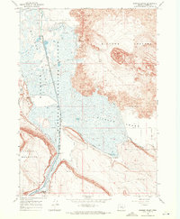
1967 · Diamond Swamp
USGS Topo · 1:24,000

1967 · Diamond
USGS Topo · 1:24,000