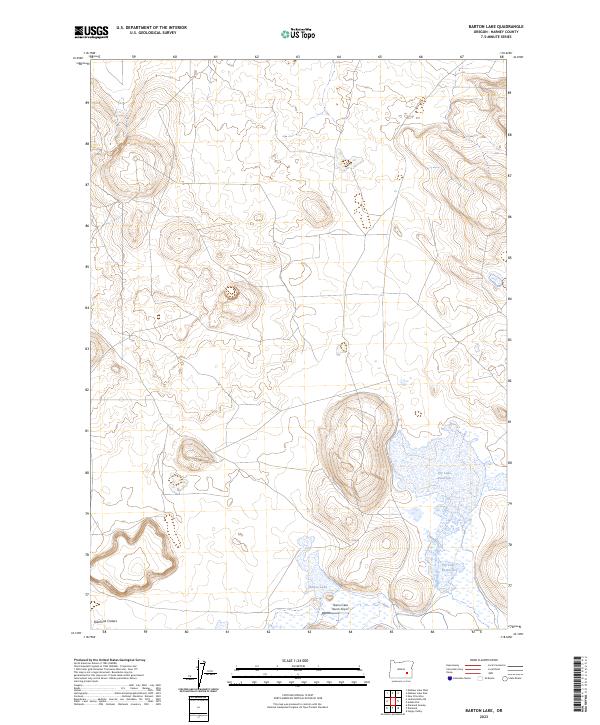
2023 Map of Barton Lake
USGS Topo · Published 2023About this map
Diamond Craters dominates the southwestern portion of this high desert landscape, showcasing the distinct volcanic geology of this corner of Harney County. The area is defined by its seasonal water features, notably Barton Lake and the expansive Dry Lake Reservoir to the east, which illustrate the delicate water management required in this arid environment. Human activity is sparse but specialized, evidenced by the Barton Lake Ranch Airport situated near the lake's southern shore. These features, along with the precise Public Land Survey System boundaries like t28s r33e, provide a clear picture of how ranching and natural landmarks intersect in the remote Oregon interior. The map captures a topography of subtle elevation changes and geological formations, essential for understanding the local land use and hydrology of the basin.
Find a feature on this map
8 named features on this map. Tap any name to fly to it.
Don’t see what you’re looking for? This feature index may not catch every label — zoom into the map to look around manually.
Map Details
Editions of this 2023 Barton Lake Map
This is the sole edition of this map. No revisions or reprints were ever made.
Other maps of this area

1955 · Burns
USGS Topo · 1:250,000

1958 · Burns
USGS Topo · 1:250,000

1959 · Burns
USGS Topo · 1:250,000

1959 · Lawen
USGS Topo · 1:62,500

1960 · Crane
USGS Topo · 1:62,500

1967 · Happy Valley
USGS Topo · 1:24,000

1967 · Jackass Butte NE
USGS Topo · 1:24,000

1967 · Barton Lake
USGS Topo · 1:24,000
1967 · Diamond Swamp
USGS Topo · 1:24,000

1967 · Diamond
USGS Topo · 1:24,000