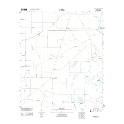
2012 Map of Bascom
USGS Topo · Published 2012About this map
The Chattahoochee River forms the eastern boundary of this agricultural and wetland landscape near the Florida-Georgia border. Small settlements like Neals Landing, Hornsville, and Lovedale dot the terrain, reflecting a history of river-oriented commerce and rural community life. The southern portion of the map is particularly water-rich, featuring numerous basins such as Bazzell Pond, Wolf Pond, and Cedar Pond, which lead into the low-lying region known as The Flatwoods.
Find a feature on this map
89 named features on this map. Tap any name to fly to it.
Don’t see what you’re looking for? This feature index may not catch every label — zoom into the map to look around manually.
Map Details
Editions of this 2012 Bascom Map
This is the sole edition of this map. No revisions or reprints were ever made.
Other maps of this area

1952 · Dellwood
USGS Topo · 1:24,000

1952 · Malone
USGS Topo · 1:24,000

1952 · Bascom
USGS Topo · 1:24,000

1952 · Marianna
USGS Topo · 1:24,000

1953 · Dothan
USGS Topo · 1:250,000

1954 · Dothan
USGS Topo · 1:250,000

1954 · Steam Mill
USGS Topo · 1:24,000

1954 · Tallahassee
USGS Topo · 1:250,000

1955 · Dothan
USGS Topo · 1:250,000

1955 · Fairchild
USGS Topo · 1:24,000