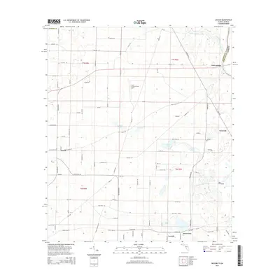
2015 Map of Bascom
USGS Topo · Published 2015About this map
The borderlands of Jackson County, Florida, and Seminole County, Georgia, converge near Neals Landing, where the landscape is defined by the proximity of the river and a series of scattered agricultural settlements. Small communities like Bascom and Hornsville anchor the rural road network, which navigates a terrain of numerous named water bodies including McArthur Pond, Cow Pond, and Brenson Pond. In the southeast, the terrain transitions into a more uniform area known as The Flatwoods near Buena Vista. Local genealogy and land history are preserved at sites like the Bazzell Cem near Lovedale. The presence of the North American Farms Airport amidst the surrounding grid of section lines and timber roads reflects the area's continued reliance on large-scale agriculture and forest management along the Irwin Mill Creek drainage.
Find a feature on this map
90 named features on this map. Tap any name to fly to it.
Don’t see what you’re looking for? This feature index may not catch every label — zoom into the map to look around manually.
Map Details
Editions of this 2015 Bascom Map
This is the sole edition of this map. No revisions or reprints were ever made.
Other maps of this area

1952 · Dellwood
USGS Topo · 1:24,000

1952 · Malone
USGS Topo · 1:24,000

1952 · Bascom
USGS Topo · 1:24,000

1952 · Marianna
USGS Topo · 1:24,000

1953 · Dothan
USGS Topo · 1:250,000

1954 · Dothan
USGS Topo · 1:250,000

1954 · Steam Mill
USGS Topo · 1:24,000

1954 · Tallahassee
USGS Topo · 1:250,000

1955 · Dothan
USGS Topo · 1:250,000

1955 · Fairchild
USGS Topo · 1:24,000