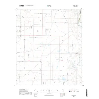
2018 Map of Bascom
USGS Topo · Published 2018About this map
The Florida Georgia state line and the Chattahoochee River define the eastern edge of this Jackson County landscape. Settlement patterns cluster around the rural hubs of Bascom and Lovedale, connected by a network of local routes like Neals Landing Rd and Concord Rd. The terrain is characterized by numerous small bodies of water, including Bazzell Pond, Brenson Pond, and McArthur Pond, which dot the northern panhandle's agricultural and timber lands. Near the river, The Flatwoods indicates the low-lying character of the river valley.
Find a feature on this map
85 named features on this map. Tap any name to fly to it.
Don’t see what you’re looking for? This feature index may not catch every label — zoom into the map to look around manually.
Map Details
Editions of this 2018 Bascom Map
This is the sole edition of this map. No revisions or reprints were ever made.
Other maps of this area

1952 · Dellwood
USGS Topo · 1:24,000

1952 · Malone
USGS Topo · 1:24,000

1952 · Bascom
USGS Topo · 1:24,000

1952 · Marianna
USGS Topo · 1:24,000

1953 · Dothan
USGS Topo · 1:250,000

1954 · Dothan
USGS Topo · 1:250,000

1954 · Steam Mill
USGS Topo · 1:24,000

1954 · Tallahassee
USGS Topo · 1:250,000

1955 · Dothan
USGS Topo · 1:250,000

1955 · Fairchild
USGS Topo · 1:24,000