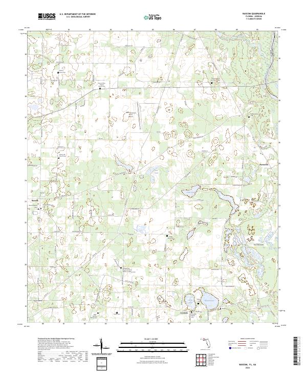
2024 Map of Bascom
USGS Topo · Published 2024About this map
Bascom and Lovedale serve as the primary hubs for this rural landscape in Jackson County, where agricultural fields are punctuated by numerous small basins and family burial grounds. The map documents an extensive network of small cemeteries, ranging from the Neel - Minchin Family Cem and Boone Family Cem to established parish sites like Mount Olive Baptist Church Cem. The eastern border is defined by the Chattahoochee River, separating Florida from Georgia, while the interior features distinct water bodies such as Cow Pond and Bazzell Pond. Specialized infrastructure like the North American Farms Airport reflects the region's agricultural industry, situated among a grid of rural routes including Neals Landing Rd and Wintergreen Rd. This 2024 edition provides a contemporary record of the area's community landmarks and water resources within The Flatwoods terrain.
Find a feature on this map
99 named features on this map. Tap any name to fly to it.
Don’t see what you’re looking for? This feature index may not catch every label — zoom into the map to look around manually.
Map Details
Editions of this 2024 Bascom Map
This is the sole edition of this map. No revisions or reprints were ever made.
Other maps of this area

1952 · Dellwood
USGS Topo · 1:24,000

1952 · Malone
USGS Topo · 1:24,000

1952 · Bascom
USGS Topo · 1:24,000

1952 · Marianna
USGS Topo · 1:24,000

1953 · Dothan
USGS Topo · 1:250,000

1954 · Dothan
USGS Topo · 1:250,000

1954 · Steam Mill
USGS Topo · 1:24,000

1954 · Tallahassee
USGS Topo · 1:250,000

1955 · Dothan
USGS Topo · 1:250,000

1955 · Fairchild
USGS Topo · 1:24,000