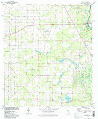
1994 Map of Bascom
USGS Topo · Published 1998About this map
The Chattahoochee River defines the eastern boundary of this northern Florida landscape, where the Florida Georgia line meets the river at Herman E Talmadge Bridge. The terrain is characterized by a high density of water bodies, including Long Pond, Wolf Pond, and Bazzell Pond, alongside the marshy expanse of The Flatwoods. Settlement is concentrated around rural junctions like Bascom and Hornsville, which are supported by a network of community anchors such as Hickory Grove Ch, Liberty Hill Ch, and Cedar Grove Ch.
Find a feature on this map
34 named features on this map. Tap any name to fly to it.
Don’t see what you’re looking for? This feature index may not catch every label — zoom into the map to look around manually.
Map Details
Editions of this 1994 Bascom Map
This is the sole edition of this map. No revisions or reprints were ever made.
Other maps of this area

1952 · Dellwood
USGS Topo · 1:24,000

1952 · Malone
USGS Topo · 1:24,000

1952 · Bascom
USGS Topo · 1:24,000

1952 · Marianna
USGS Topo · 1:24,000

1953 · Dothan
USGS Topo · 1:250,000

1954 · Dothan
USGS Topo · 1:250,000

1954 · Steam Mill
USGS Topo · 1:24,000

1954 · Tallahassee
USGS Topo · 1:250,000

1955 · Dothan
USGS Topo · 1:250,000

1955 · Fairchild
USGS Topo · 1:24,000