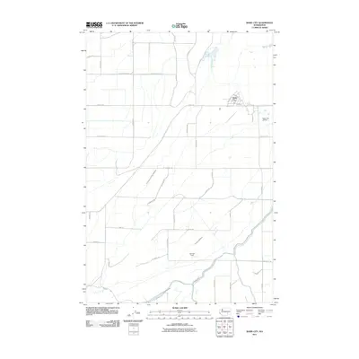
2011 Map of Basin City
USGS Topo · Published 2011About this map
Basin City serves as the central hub of this agricultural landscape in Franklin County, characterized by a highly structured grid of irrigation and transport. The local economy and movement are defined by an extensive network of wasteways, including the P E Sixteen Point Four Wasteway and the Forty-six A Wasteway, which manage water across the low-lying terrain. These man-made channels are critical to the region's productivity, supporting the rural farms connected by long, straight thoroughfares like Sagehill Rd and Wahluke Rd. Aviation infrastructure is notably present through the Basin City Airfield and Dorman Field, highlighting the importance of aerial access for crop management or local transport. The town itself is compactly arranged along Bailie Blvd and First Ave, forming a sharp contrast to the wide-reaching fields that stretch toward the Ringold Wasteway in the south.
Find a feature on this map
47 named features on this map. Tap any name to fly to it.
Don’t see what you’re looking for? This feature index may not catch every label — zoom into the map to look around manually.
Map Details
Editions of this 2011 Basin City Map
This is the sole edition of this map. No revisions or reprints were ever made.
Other maps of this area

1917 · Pasco
USGS Topo · 1:125,000

1924 · Hanford
USGS Topo · 1:62,500

1925 · Scooteney Lake
USGS Topo · 1:62,500

1951 · Scooteney Lake
USGS Topo · 1:62,500

1951 · Richland
USGS Topo · 1:62,500

1951 · Hanford
USGS Topo · 1:62,500

1953 · Walla Walla
USGS Topo · 1:250,000

1958 · Walla Walla
USGS Topo · 1:250,000

1965 · Mesa
USGS Topo · 1:62,500

1965 · Eltopia
USGS Topo · 1:62,500